Spatial Datasets
Thompson Farm Property Boundary: [KML] [ESRI shapefile]
LiDAR data collected by State of NH in 2011 at 2-meter resolution are available at: https://lidar.unh.edu
(Tiles 19_03404773 and 19_03404774 cover Thompson Farm).
G-LiHT (LiDAR, hyperspectral, and thermal remote sensing). Thompson Farm swath acquired June 2016.
Data are available at: https://glihtdata.gsfc.nasa.gov
UAV-based LiDAR:
Aerial Photography (as early as 1962) are available from GRANIT:
https://new-hampshire-geodata-portal-1-nhgranit.hub.arcgis.com/search?tags=Aerial%20image
Additional statewide and GIS datasets are available from GRANIT:
https://new-hampshire-geodata-portal-1-nhgranit.hub.arcgis.com/
Long-term observations
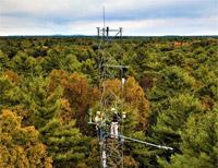
AERONET - Aerosol Optical Depth (mounted on walk-up tower, data start in 2006):
https://aeronet.gsfc.nasa.gov/cgi-bin/data_display_aod_v3?site=Thompson_Farm
PhenoCam - tree canopy phenology (mounted on walk-up tower, data start in 2016):
https://phenocam.sr.unh.edu/webcam/sites/tfforest/
AIRMAP air quality data (1999-2012):
http://www.eos.sr.unh.edu/observatories/data.shtml
- Contosta, A.R., S.D. Frey, and A. Perry. 2024. New Hampshire Soil Sensor Network: Air Temperature, Soil Temperature, Soil Water Content, and Soil Electrical Conductivity, 2012 - ongoing ver 1. Environmental Data Initiative.
https://doi.org/10.6073/pasta/9f31b023820f207979e9c07275d0a84e - Contosta, A.R., S.D. Frey, A. Perry, and R. Varner. 2025. New Hampshire Soil Sensor Network: Soil CO2 Fluxes ver 3. Environmental Data Initiative.
https://doi.org/10.6073/pasta/14e1189b2e8ce9bbea8766fd1c6a61ed
Meteorological data
Meteorological data beginning in 2010 at a range of time scales (monthly, daily, hourly, and 5-minute) are available from the NOAA CRN Thompson Farm station (WBAN #54795; NH Durham 2 SSW) at: https://www.ncdc.noaa.gov/crn/qcdatasets.html
Biodiversity data
Plant and bird species lists are included in the stewardship plan
Project-specific data archives
Vadeboncoeur, M.A., S.J. Tumber-Dávila, and A.P. Ouimette. 2023. Soil physical, chemical, and root data from forest stands at Thompson Farm in Durham, NH ver 1. Environmental Data Initiative.
https://doi.org/10.6073/pasta/cb301b6626b614506cd95c8174a48401
Vadeboncoeur, M.A., K.A. Jennings, A.P. Ouimette, and H. Asbjornsen. 2022. Wood alpha-cellulose stable C and O isotope ratios from New Hampshire and Vermont ver 2. Environmental Data Initiative. https://doi.org/10.6073/pasta/4f307ee004b8835a0dec16093a99e92b
Ouimette, A.P., J.H. Hastings, S. Zuckerman, M.A. Vadeboncoeur, K. Baillargeon, S.V. Ollinger, and H. Asbjornsen. 2023. Leaf temperature of northeastern US tree species ver 1. Environmental Data Initiative. https://doi.org/10.6073/pasta/964891a1931f6b562ffa8ce538f29b7f
Baillargeon, K.A., A.P. Ouimette, J.H. Hastings, R. Sanders-DeMott, and S.V. Ollinger. 2023. Regional and local variation in chemical, structural, and physical leaf traits for tree species in the northeastern United States ver 1. Environmental Data Initiative. https://doi.org/10.6073/pasta/067108e9983d30d9149c14fc649f75c1
Hastings, J.H., K. Baillargeon, A.P. Ouimette, and S.V. Ollinger. 2023. Leaf angle measurements for temperate tree species in northeastern USA ver 1. Environmental Data Initiative. https://doi.org/10.6073/pasta/faa03b13e5eab16a5e46a4ba0c2123e5