by Gabriella Gurney, guest contributor
February 7, 2023
USDA. NRCS. UNH. UVM. AMC. NESS. Scientific work tends to have a lot of acronyms, and navigating who’s who – and what they do – can be tough.
NESS is no exception- with so many partner organizations, locations, and possible goals, understanding exactly what NESS is and what it’s for can seem confusing. Luckily, we have here a handy guide to NESS, who’s involved, and what we’re doing.
What’s NESS?
NESS stands for Northeast Snow Survey Feasibility Study. The goal of NESS is to create a network of automated weather stations positioned in backcountry, hard-to-reach areas along the northeast mountains in order to monitor snowpack, weather, and water (hydrology). With automated weather stations, we can collect data that helps inform our understanding of climate change on mountain snowfall and runoff, mountain ecology, flood and avalanche danger, backcountry recreation, and tourism.
The precedent for NESS comes from the Snow Telemetry (SNOTEL) Network in the mountainous regions of the western U.S. Administered by the National Water and Climate Center, SNOTEL sites monitor snowpack, temperature, precipitation, and other climate items, and are used to make water supply forecasts. The SNOTEL network has been running since the 1970s, and provides a wealth of long-term data to learn from.
Why set up NESS?
While the western U.S. has had SNOTEL since the ‘70s, the northeast lacks a connected system of long-term weather stations. While there are some individual sites that have been historically collecting weather and snow data, they’re disconnected and aren’t coordinated with one another. A cohesive system will provide better data across a bigger area, helping to inform what we know about changing climate in the northeast.
Who’s Involved?
There are a variety of partners currently involved with NESS! These currently include the Natural Resources Conservation Service (NRCS), the University of New Hampshire, the University of Vermont, the Appalachian Mountain Club, the Schoodic Institute and the State University of New York at Albany (SUNY-Albany). Current partners are working together to identify NESS’s goals and make them a reality.
What are the goals?
The ultimate goal of NESS is to establish a system of long-term weather monitoring stations that collect snow, water, and temperature data, among other things. This data will be available for scientists to track weather changes, make water estimates, and predict flooding events.
As climate change continues to impact our daily lives, understanding what kinds of changes are happening — and being able to anticipate and prepare for major events, like flooding — is critical in managing our response at a local, state, and federal level.
Where are we now?
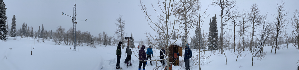
NESS partners met on January 17, 2024 in Salt Lake City, Utah to visit a SNOTEL site and talk about what’s needed to establish the NESS network. Using the experience of our western SNOTEL partners and based on the differences in climate in the Northeast, what equipment is needed, how to find the best area for sites, and what kind of funding is necessary were all discussed.
Next steps include a stakeholder meeting in the Northeast and defining more concrete needs and wants for sites.
Setting up a comprehensive network like NESS takes time, energy, and investment from partners. However, with a thorough planning process and strong collaboration, NESS will be set up to provide climate data and information that helps inform scientists and the public for years to come!